07 / 08
2024
What happens if the Netherlands ends up underwater? With “WHAT-IF: NL 2100”, MVRDV gives shape to 21st-century dilemmas...
> The Tribune by MVRDV
> The Pyramid of Tirana by MVRDV inaugurated
From the architect: The Netherlands has always been a country that deals in the improbable. Much of the area that now makes up the country was once swampy marshland or even sea. Thanks to centuries of cultivation and incomparable engineering know-how, this inhospitable environment somehow became one of Europe’s most densely populated countries, one of the world’s largest economies, and the world’s second-largest agricultural exporter – trailing only the USA, a country with over 200 times as much land. But what happens when the improbability of Dutch society collides with the inevitability of challenges such as global climate change or shifts in demographics? Will the 21st Century be the end of the Netherlands? Or could new, ever-more-radical solutions guide the country through even the most extreme possible scenarios?
These are among the questions tackled in a new publication, WHAT-IF: Nederland 2100, in which three urbanism and landscape design studios – MVRDV, IMOSS, and Feddes/Olthof – investigated the difficult decisions that the country is likely to face in the coming century, culminating in visions showing how the Netherlands can learn to live with nature, provide housing and quality of life, protect its cultural heritage, and adapt its economy to a new normal. Published by Platform Ontwerp NL in collaboration with the Beautiful Netherlands Programme (“Programma Mooi Nederland”) of the Dutch Ministry of the Interior and Kingdom Relations (BZK), the study aims to make the future imaginable for a broad audience and indicate the steps necessary to reach that future.
This effort is not simply an academic exercise: with an incoming Dutch government that will likely introduce new spatial planning policies, WHAT-IF: Nederland 2100 provides material for social debate and political choices that could have serious real-life consequences. Beyond the specific context of the Netherlands, the study has relevance for over 900 million people worldwide who live in low-lying coastal areas that are threatened by climate change.
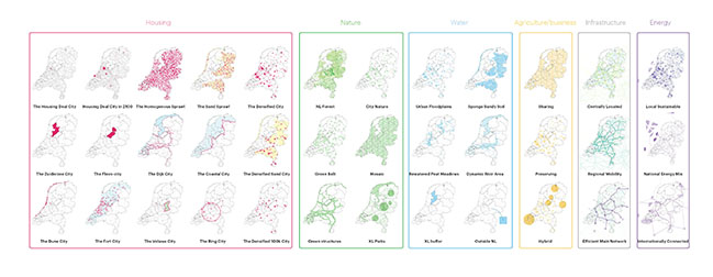
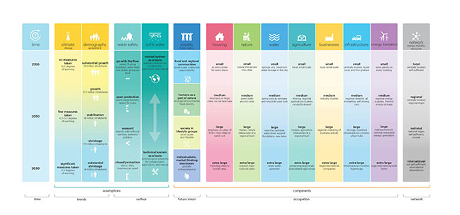
To provide a framework to underpin the work of all three studios, MVRDV developed the decision matrix, a kind of “mixing deck” for future scenarios. It introduces sliding scales for a variety of spatial planning considerations, from the severity of global warming and population growth to the approach to dealing with sea level rise (from technological to nature-based approaches), and from the political climate to the way that housing, nature, agriculture, industry, infrastructure, and other functions are distributed. This decision matrix helps to define a coherent storyline for a future scenario, thus offering an underlying explanation for each of the visions proposed.
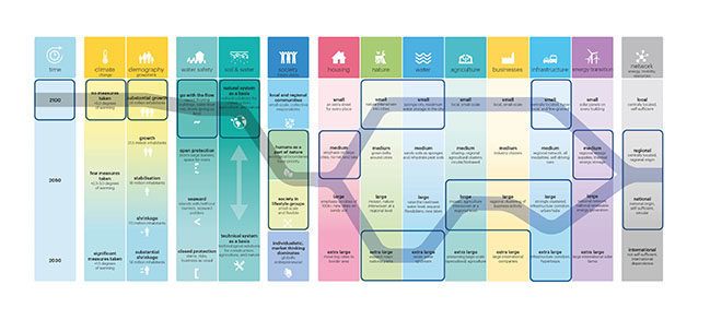
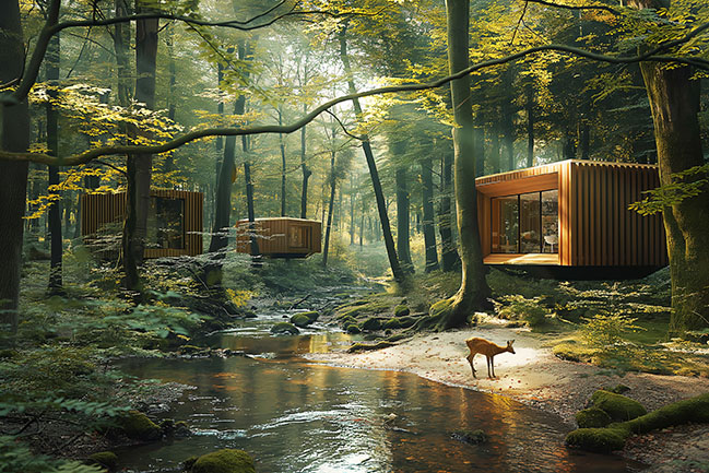
For all three studios, the decision was made to investigate an extreme scenario: the maximum predicted global warming, and the maximum projected population growth. These scenarios would likely also necessitate a change in approach to dealing with water, so the assumption was made that in future Dutch society would stop fighting the encroaching sea. Instead of manufacturing the landscape to suit people’s lifestyle as happens today, lifestyles would adapt to suit the landscape. This dramatic storyline allowed the studios to demonstrate that even the most challenging conditions can be reckoned with, as long as bold choices are made in plenty of time.
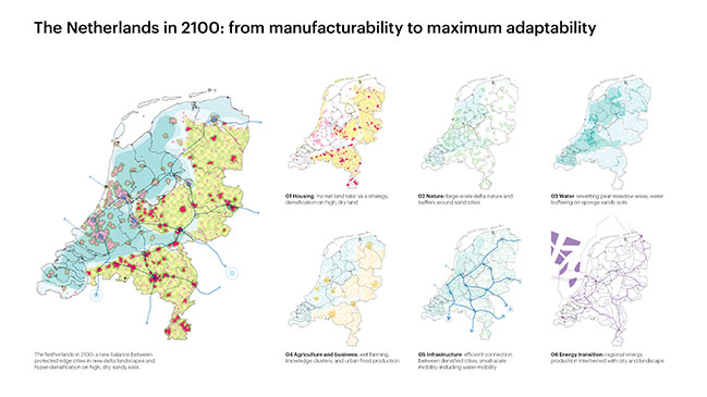
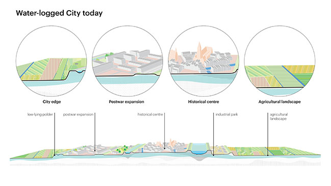
The extreme rise in sea levels, combined with the new approach to water, would mean that the low-lying western parts of the Netherlands, which today are home to the country’s largest cities and the majority of the population, would no longer be protected from the sea. The country would inevitably be divided between “water-logged cities” in the west and higher, drier “sand cities” in the east.
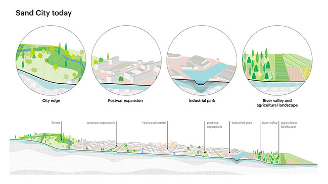
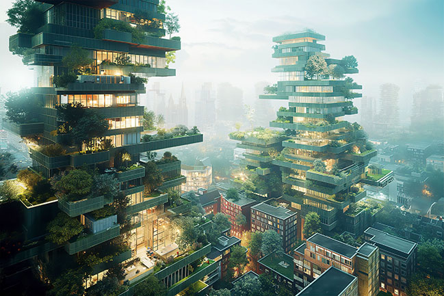
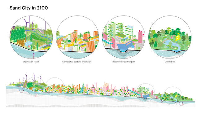
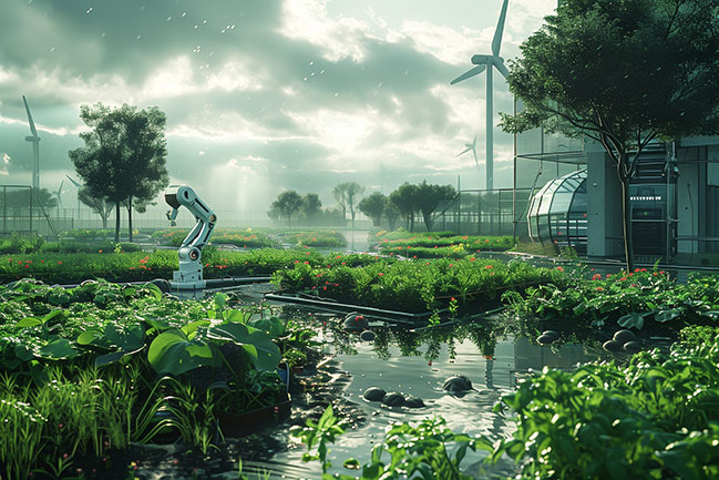
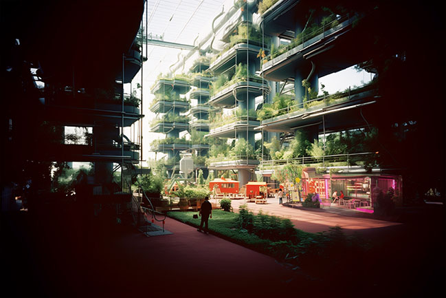
Given this hydrological divide, MVRDV established two complementary combinations within the decision matrix. The sand cities of the east become hyper-dense, with all land uses turned to high intensity. In contrast to the current situation, these cities will be tasked with housing the majority of population growth and economic activity. Residential areas will be redeveloped for maximum density, agriculture will be stacked into vertical farms, green belts around the cities will provide buffer zones for rainwater and production of bio-based materials, and residents will find usable green space on top of every roof.
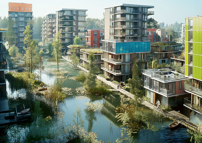
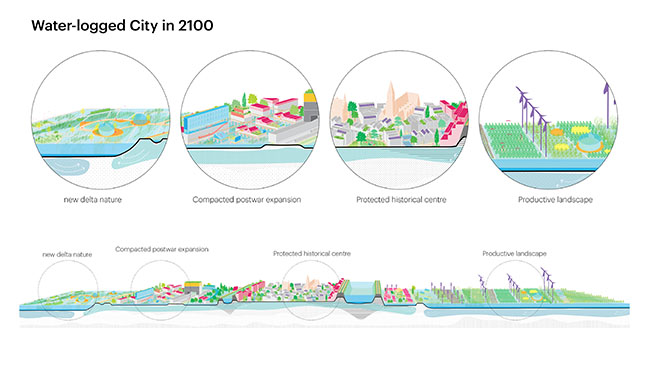
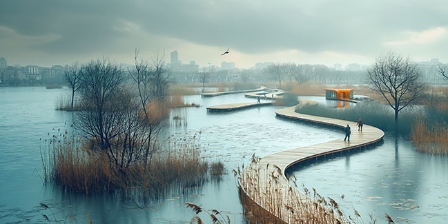
Meanwhile, the waterlogged cities of the west could take a very different path, with flooding giving rise to a necessary new reality. To protect important heritage buildings, the historic centres of cities like Amsterdam would be encircled by large raised dikes. Buildings that have survived below sea level for centuries would therefore continue to be protected – but saving everything in this way does not seem feasible. Outside these dikes, the neighbourhoods that developed in the postwar period will adapt to a new life living in harmony with the water. Ground floors will be emptied out with rooftop extensions compensating for the flooded housing, while a new “ground” level network of walkways will connect the buildings. Beyond these neighbourhoods, in place of traditional agriculture and industry, the production of biobased materials will become the dominant land use alongside large swathes of natural delta landscape. Getting around with boats and other forms of small-scale water transport will become the norm. The waterlogged cities become pioneers of resilience and adaptability in tune with nature – although not everything will become small-scale, with a hypermodern intercity transit network built into the large protective dikes.
“What we hope to communicate in this study is an idea of what’s possible”, says MVRDV founding partner Winy Maas. “It might seem hard to imagine right now, but we could live in a flooded landscape if we have to. We could make farms in towers if we wanted to. We could turn Enschede into the most populated city in the Netherlands if we wanted to. What we can’t do is continue with the status quo, building in ways we know are not sustainable, not resilient, not flexible, in a country that is largely below sea level. Right now, we need a total switch in our understanding of what seems normal and sensible, and what seems foolish and untenable.”
WHAT-IF: Nederland 2100 was commissioned by Platform Ontwerp NL, an advocacy platform made up of a collaboration between the Dutch professional organisations for architects (BNA), engineers (Koninklijke Nederlandse Ingenieurs), urban planners (BNSP), landscape architects (NVTL), and interior designers (BNI), along with the Federation of Spatial Quality and the Deltametropolis Association. The study was presented on June 3rd to Irene Jansen, Director of Space and Living Environment at the Ministry of the Interior and Kingdom Relations.
Architect: MVRDV
Client: Platform Ontwerp NL
Location: The Netherlands
Year: 2023 - 2024
Founding Partner in charge: Winy Maas
Design Team: Stephan Boon, Stijn Lant
Additional contributing designers: IMOSS, Feddes/Olthof
Subsidy: Ministry of the Interior and Kingdom Relations (BZK), Programma Mooi Nederland
Platform Ontwerp NL member organisations: Royal Institute of Dutch Architects (BNA), Koninklijke Nederlandse Ingenieurs, Professional Association of Dutch Urbanists and Planners (BNSP), Federatie Ruimtelijke Kwaliteit, Dutch Society for Garden and Landscape Architecture (NVTL), Association Deltametropool, Professional Association of Dutch Interior Architects (BNI)
Images: MVRDV
WHAT-IF: Nederland 2100 by MVRDV
07 / 08 / 2024 What happens if the Netherlands ends up underwater? With "WHAT-IF: NL 2100", MVRDV gives shape to 21st-century dilemmas...
You might also like:
Recommended post: Sierra House in Madrid by Steyn Studio
